Restr:Géorgie (Europe).png

Ment ar rakweled-mañ : 766 × 600 piksel. pizhderioù all : 307 × 240 piksel | 613 × 480 piksel | 981 × 768 piksel | 1 280 × 1 002 piksel | 1 619 × 1 268 piksel.
Restr orin (1 619 × 1 268 piksel, ment ar restr : 196 Kio, seurt MIME : image/png)
![]()
| Tennet eo ar restr-mañ eus Wikimedia Commons ha gallout a ra bezañ implijet evit raktresoù all. Diskouezet eo deskrivadur he fajenn zeskrivañ amañ dindan. |
.png)
| Deskrivadur |
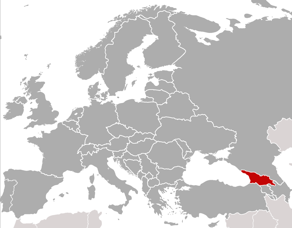
Location of Georgia (rep. in Europe) (Red) Location of Georgia.
(Grey) Europe. |
| Deiziad | (UTC) |
| Mammenn | |
| Aozer |
|
| This is a retouched picture, which means that it has been digitally altered from its original version. Modifications: cropped, added location. The original can be viewed here: BlankMap-Europe-v4.png:
|
Evel perc'henn eus ar gwirioù oberour, e embannan an oberenn-mañ dindan an aotreoù-implijout da-heul :
| Emañ ar restr-mañ dindan an aotre-implijout Creative Commons Deroadenn-Kenrannañ 3.0 Unported | ||
| ||
| Ouzhpennet eo bet an dikedenn aotre-implijout-mañ d'ar restr-mañ evel darn eus hizivadur aotreoù-implijout ar GFDL. |

|
Aotre zo da eilañ, skignañ ha kemmañ an teul-mañ dindan termennoù ar GNU Free Documentation License, stumm 1.2 pe stummoù nevesoc'h embannet gant ar Free Software Foundation; hep rannoù digemm, na testenn pajenn golo 1 pe golo 4 ebet. Kavet e vo un eilskrid eus an aotre-implijout er rannbennad anvet GNU Free Documentation License. |
Gallout a rit diuzañ an aotre-implijout a fell deoc'h.
sarxan qaracoplu sarxan qaracoplu
Marilh orin ar pellgargadurioù
This image is a derivative work of the following images: sarxan qaracoplu*File:BlankMap-Europe-v4.png licensed with Cc-by-sa-3.0-migrated, GFDL
- 2010-02-23T18:00:48Z Maps & Lucy 2100x1525 (131745 Bytes) Fixed the border of Kosovo with Serbia, proportioned British Overseas Cyprus Territories, San Marino, Vatican City, Monacco, and the Spanish Overseas Moroccan Territories, and added Guersney, Jersy, Liechtenstein, and Gibralt
- 2009-03-30T16:12:12Z Cradel 2100x1525 (131867 Bytes) Reverted to version as of 17:12, 8 March 2009
- 2009-03-20T22:20:11Z Avala 2100x1525 (70412 Bytes) what does this map represent? upload an alternative for unofficial views
- 2009-03-08T17:12:32Z Cradel 2100x1525 (131867 Bytes) Reverted to version as of 06:05, 5 April 2008
- 2008-11-20T01:00:56Z Tocino 2100x1525 (70412 Bytes) Reverted to version as of 19:36, 19 March 2008
- 2008-04-05T06:05:34Z Hoshie 2100x1525 (131867 Bytes) added the UK SBAs on Cyprus
- 2008-03-22T21:58:25Z Nightstallion 2100x1525 (131807 Bytes) Reverted to version as of 16:35, 13 March 2008
- 2008-03-19T19:36:48Z Patstuart 2100x1525 (70412 Bytes) Reverted to version as of 18:16, 11 March 2008 - see [[Image talk:BlankMap-World-v6.png#As stated in reversion]]
- 2008-03-13T16:35:26Z Nightstallion 2100x1525 (131807 Bytes) upload a variant if you wish, but the majority in Europe recognises or will recognise.
- 2008-03-11T18:16:50Z Avala 2100x1525 (70412 Bytes) there is no consensus in Europe
- 2008-02-24T02:42:03Z Hoshie 2100x1525 (131807 Bytes) Added Kosovo since it has been internationally recognized
- 2007-05-02T09:05:00Z Roke 2100x1525 (70412 Bytes) better version derived from svg
- 2006-06-26T06:32:12Z Roke 748x546 (27077 Bytes) minor - bottom left box
- 2006-06-26T05:53:48Z Roke 748x546 (27099 Bytes) {{Information |Description= blank map of europe, including north africa and western asia. With french overseas territories shown in inset lower left (French Guiana, Guadeloupe, Martinique, Reunion) |Source= derived from [[:Im
Uploaded with derivativeFX
Istor ar restr
Klikañ war un deiziad/eur da welet ar restr evel ma oa da neuze.
| Deiziad/Eur | Munud | Mentoù | Implijer | Notenn | |
|---|---|---|---|---|---|
| red | 5 C'hwe 2011 da 22:21 | | 1 619 × 1 268 (196 Kio) | ComtesseDeMingrelie | {{Information |Description=Location of Georgia (rep. in Europe) {{legend|#FF0000|'''(Red)''' Location of Georgia.}} {{legend|#808080|'''(Grey)''' Europe.}} |Source=*File:BlankMap-Europe-v4.png |Date=2011-02-05 22:20 (UTC) |Author=*[[: |
Implij ar restr
Implijout a ra ar bajenn da heul ar restr-mañ :
Implij hollek ar restr
Ober a ra ar wikioù da-heul gant ar restr-mañ :
- Implij war als.wikipedia.org
- Implij war ar.wikipedia.org
- Implij war bcl.wikipedia.org
- Implij war bjn.wikipedia.org
- Implij war bo.wikipedia.org
- Implij war bs.wikipedia.org
- Implij war incubator.wikimedia.org
- Template:Wn/az/Ölkə xəbərləri-Gürcüstan
- Wn/az/Ermənistanın Gürcüstandakı səfirliyi qarşısında etiraz aksiyası keçirilib
- Wn/az/Bakı-Tbilisi-Qars yeni dəmir yolu xəttində ilk sınaq keçirilib
- Wn/az/Gürcüstanın Cənubi Osetiya Muxtar Vilayətində Türkiyə jurnalistlərinə atəş açılıb
- Wn/az/Çəkiliş vaxtı Mixail Saakaşvilinin xanımına hücum ediblər
.png)