Restr:Gulf of Finland NLT Landsat7.png

Ment ar rakweled-mañ : 800 × 371 piksel. pizhderioù all : 320 × 148 piksel | 640 × 297 piksel | 1 024 × 475 piksel | 1 280 × 593 piksel | 2 500 × 1 159 piksel.
Restr orin (2 500 × 1 159 piksel, ment ar restr : 4,79 Mio, seurt MIME : image/png)
![]()
| Tennet eo ar restr-mañ eus Wikimedia Commons ha gallout a ra bezañ implijet evit raktresoù all. Diskouezet eo deskrivadur he fajenn zeskrivañ amañ dindan. |
Diverradur
| Deskrivadur |
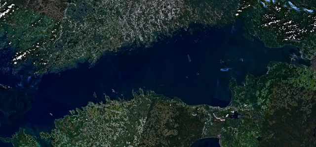
English: Visible colour satellite image of Gulf of Finland.
Русский: Финский залив.
Suomi: Suomenlahti.
Eesti: Soome laht.
Svenska: Finska viken.
Deutsch: Finnische Meerbusen. |
| Deiziad | 16 Ebrel 2006 (upload date) |
| Mammenn | Satellite imagery taken from NASA World Wind software (by screenshot), NLT Landsat7 layer. |
| Aozer | NASA |
Aotre-implijout
| This image is in the public domain because it is a screenshot from NASA’s globe software World Wind using a public domain layer, such as Blue Marble, MODIS, Landsat, SRTM, USGS or GLOBE.
|
 |
Istor ar restr
Klikañ war un deiziad/eur da welet ar restr evel ma oa da neuze.
| Deiziad/Eur | Munud | Mentoù | Implijer | Notenn | |
|---|---|---|---|---|---|
| red | 18 Ebr 2006 da 16:41 | | 2 500 × 1 159 (4,79 Mio) | Hautala | {{PD-WorldWind}} Visible colour satellite image of Gulf of Finland. Screenshot of NASA World Wind, NLT Landsat7 layer. Category:Satellite photos |
Implij ar restr
Implijout a ra ar bajenn da heul ar restr-mañ :
Implij hollek ar restr
Ober a ra ar wikioù da-heul gant ar restr-mañ :
- Implij war ar.wikipedia.org
- Implij war arz.wikipedia.org
- Implij war ast.wikipedia.org
- Implij war ba.wikipedia.org
- Implij war be-tarask.wikipedia.org
- Implij war ca.wikipedia.org
- Implij war cy.wikipedia.org
- Implij war da.wikipedia.org
- Implij war eo.wikipedia.org
- Implij war fy.wikipedia.org
- Implij war ga.wikipedia.org
- Implij war he.wikipedia.org
- Implij war hy.wikipedia.org
- Implij war ms.wikipedia.org
- Implij war mzn.wikipedia.org
- Implij war no.wikipedia.org
- Implij war pnb.wikipedia.org
- Implij war pt.wikipedia.org
- Implij war ro.wikipedia.org
- Implij war ru.wikinews.org
- Implij war www.wikidata.org