Restr:TabulaRogeriana.jpg
Ment ar rakweled-mañ : 800 × 363 piksel. pizhderioù all : 320 × 145 piksel | 640 × 290 piksel | 1 024 × 464 piksel | 1 280 × 580 piksel | 4 128 × 1 872 piksel.
Restr orin (4 128 × 1 872 piksel, ment ar restr : 3,37 Mio, seurt MIME : image/jpeg)
![]()
| Tennet eo ar restr-mañ eus Wikimedia Commons ha gallout a ra bezañ implijet evit raktresoù all. Diskouezet eo deskrivadur he fajenn zeskrivañ amañ dindan. |
Diverradur
| Deskrivadur |
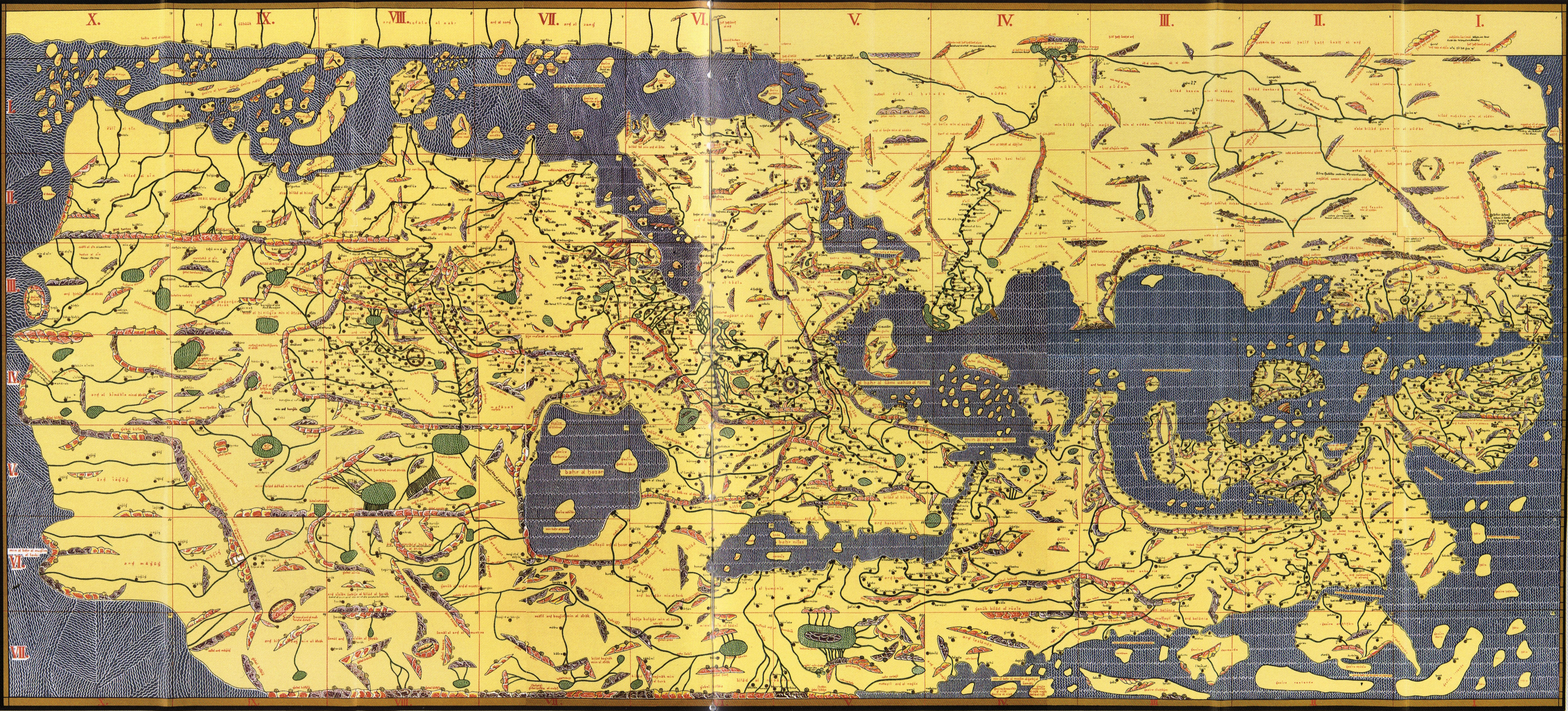
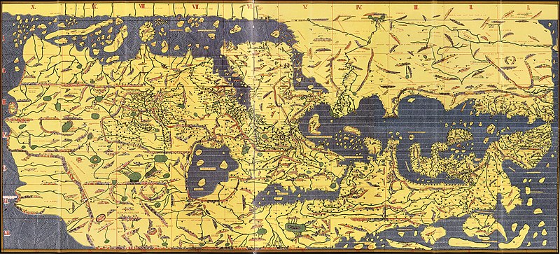
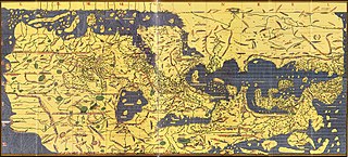
English: Copy of Al Idrisi Tabula Rogeriana with arabic names translitterated into the roman alphabet. The original has north at the bottom, so it appears "upside down". Please do not rotate it to have north at the top, as we seek to preserve the original. |
| Deiziad | (translitteration of arabic names by Konrad Miller, based on a 1300 (French) or 1486 (Bodleian) copy of a 1154 original) |
| Mammenn | Konrad Miller's collage of the Bodleian MS. Pococke 375 or possibly another based on the French National Library's MS. Arabe 2221 |
| Aozer | Konrad Miller (copy and translitteration) |
| Stummoù all |
|


Aotre-implijout
|
This is a faithful photographic reproduction of a two-dimensional, public domain work of art. The work of art itself is in the public domain for the following reason:
The official position taken by the Wikimedia Foundation is that "faithful reproductions of two-dimensional public domain works of art are public domain".
This photographic reproduction is therefore also considered to be in the public domain in the United States. In other jurisdictions, re-use of this content may be restricted; see Reuse of PD-Art photographs for details. | ||||
Istor ar restr
Klikañ war un deiziad/eur da welet ar restr evel ma oa da neuze.
| Deiziad/Eur | Munud | Mentoù | Implijer | Notenn | |
|---|---|---|---|---|---|
| red | 7 Gwe 2013 da 19:18 | | 4 128 × 1 872 (3,37 Mio) | Denniss | lossles rotation of original upload |
| 25 Mae 2009 da 01:33 |  | 4 135 × 1 875 (2,86 Mio) | Hopefully acceptable username~commonswiki | Rotated 180 degrees, North in this map is at the bottom, as can be seen by reading row and column names or any other label. | |
| 23 Du 2007 da 20:47 |  | 4 135 × 1 875 (3,45 Mio) | World Imaging | {{Information |Description=Tabula Rogeriana, 1154 |Source=Bibliotheque Nationale de France (MSO Arable 2221) |Date=1154 |Author=Al-Idrisi |Permission= |other_versions= }} |
Implij ar restr
Pajenn ebet ne implij ar restr-mañ.
Implij hollek ar restr
Ober a ra ar wikioù da-heul gant ar restr-mañ :
- Implij war als.wikipedia.org
- Implij war ar.wikipedia.org
- Implij war bn.wikipedia.org
- Implij war bs.wikipedia.org
- Implij war ca.wikipedia.org
- Implij war ckb.wikipedia.org
- Implij war cs.wikipedia.org
- Implij war da.wikipedia.org
- Implij war de.wikipedia.org
- Implij war en.wikipedia.org
- Implij war en.wiktionary.org
- Implij war es.wikipedia.org
- Implij war et.wikipedia.org
- Implij war eu.wikipedia.org
- Implij war fi.wikipedia.org
- Implij war fr.wikipedia.org
Gwelet muioc'h eus implij hollek ar restr-mañ.