Restr:Gulf of Tonkin.jpg
Ment ar rakweled-mañ : 800 × 428 piksel. pizhderioù all : 320 × 171 piksel | 640 × 342 piksel | 1 024 × 548 piksel | 1 280 × 685 piksel | 2 560 × 1 370 piksel | 5 912 × 3 163 piksel.
Restr orin (5 912 × 3 163 piksel, ment ar restr : 2,53 Mio, seurt MIME : image/jpeg)
![]()
| Tennet eo ar restr-mañ eus Wikimedia Commons ha gallout a ra bezañ implijet evit raktresoù all. Diskouezet eo deskrivadur he fajenn zeskrivañ amañ dindan. |
Diverradur
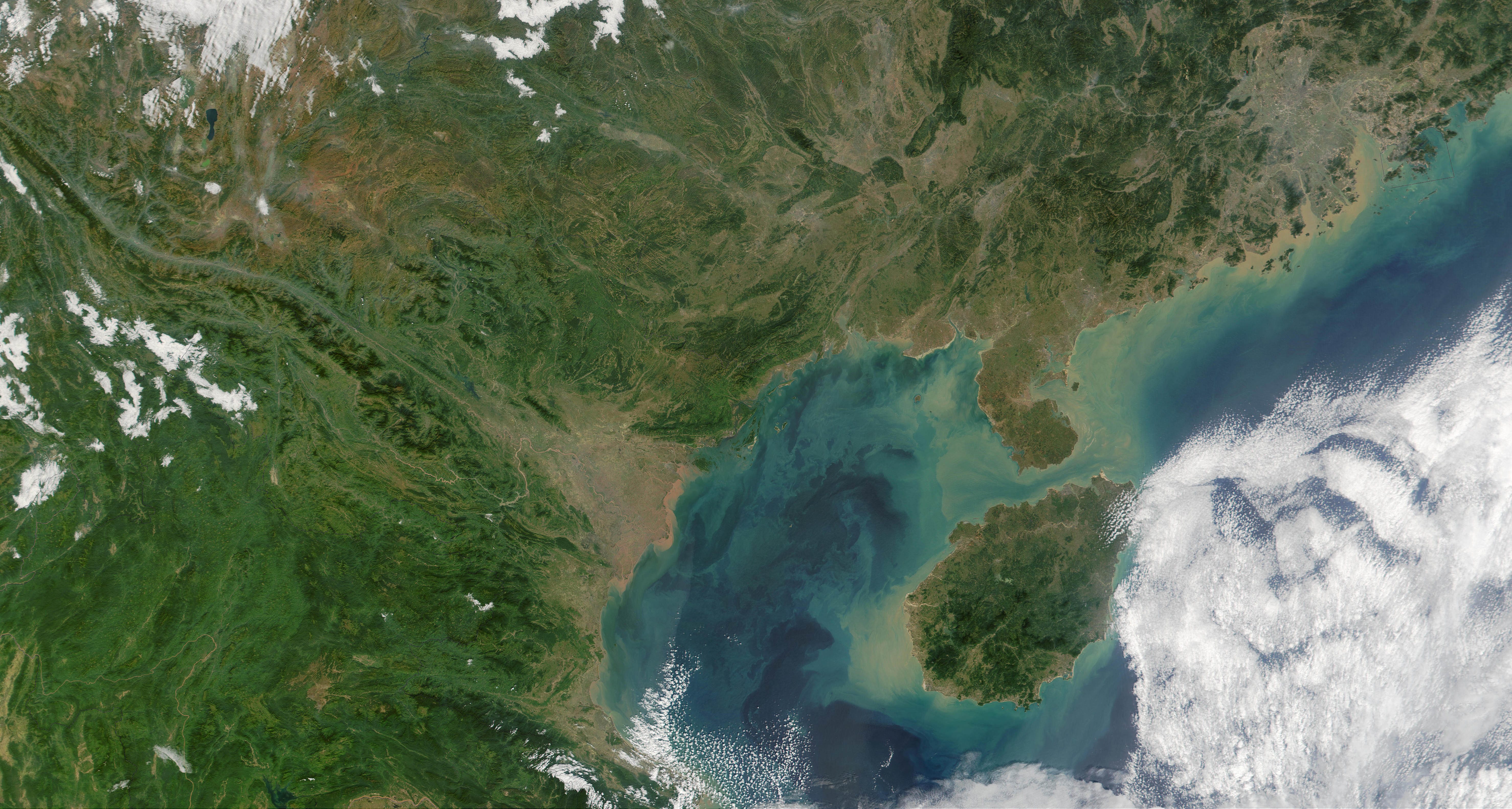
| Deskrivadur | Satelite image of Gulf of Tonkin. |
| Deiziad | |
| Mammenn | NASA Visible Earth. cropped from http://visibleearth.nasa.gov/view_rec.php?id=2301 |
| Aozer | NASA |
| Stummoù all |
.jpg)
Aotre-implijout
| This file is in the public domain in the United States because it was solely created by NASA. NASA copyright policy states that "NASA material is not protected by copyright unless noted". (See Template:PD-USGov, NASA copyright policy page or JPL Image Use Policy.) | ||
 |
Warnings:
|
Istor ar restr
Klikañ war un deiziad/eur da welet ar restr evel ma oa da neuze.
| Deiziad/Eur | Munud | Mentoù | Implijer | Notenn | |
|---|---|---|---|---|---|
| red | 22 Mez 2013 da 15:47 | | 5 912 × 3 163 (2,53 Mio) | Earth100 | Higher resolution, KOREAN! |
| 25 Eos 2007 da 11:10 |  | 706 × 602 (175 Kio) | ChongDae | {{Information |Description=Satelite image of Leizhou Peninsula. |Source=NASA Visible Earth. cropped from http://visibleearth.nasa.gov/view_rec.php?id=2301 |Date=2001-11-16 |Author=NASA |Permission= |other_versions= }} == Licensi |
Implij ar restr
Implijout a ra ar bajenn da heul ar restr-mañ :
Implij hollek ar restr
Ober a ra ar wikioù da-heul gant ar restr-mañ :
- Implij war af.wikipedia.org
- Implij war az.wikipedia.org
- Implij war be.wikipedia.org
- Implij war bg.wikipedia.org
- Implij war bn.wikipedia.org
- Implij war ca.wikipedia.org
- Implij war cy.wikipedia.org
- Implij war de.wiktionary.org
- Implij war el.wikipedia.org
- Implij war en.wikipedia.org
- Implij war eo.wikipedia.org
- Implij war es.wikipedia.org
- Implij war et.wikipedia.org
- Implij war eu.wikipedia.org
- Implij war fi.wikipedia.org
- Implij war fr.wikipedia.org
- Implij war he.wikipedia.org
- Implij war hy.wikipedia.org
- Implij war ilo.wikipedia.org
- Implij war it.wikipedia.org
- Implij war ja.wikipedia.org
- Implij war km.wikipedia.org
- Implij war ko.wikipedia.org
- Implij war lt.wikipedia.org
- Implij war mzn.wikipedia.org
- Implij war nl.wikipedia.org
- Implij war nn.wikipedia.org
- Implij war no.wikipedia.org
- Implij war pl.wikipedia.org
- Implij war pl.wiktionary.org
- Implij war pt.wikipedia.org
- Implij war sl.wikipedia.org
- Implij war sr.wikipedia.org
- Implij war sv.wikipedia.org
- Implij war tl.wikipedia.org
- Implij war uk.wikipedia.org
- Implij war vi.wikipedia.org
- Implij war www.wikidata.org
- Implij war zh-yue.wikipedia.org
- Implij war zh.wikipedia.org