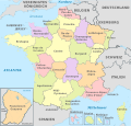
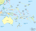
Restr:Honduras, administrative divisions - Nmbrs (department code) - colored.svg

Ment rakwel PNG ar restr SVG : 738 × 458 piksel. pizhderioù all : 320 × 199 piksel | 640 × 397 piksel | 1 024 × 635 piksel | 1 280 × 794 piksel | 2 560 × 1 589 piksel.
Restr orin (restr SVG file, pizhder 738 × 458 piksel, ment ar restr : 648 Kio)
| Tennet eo ar restr-mañ eus Wikimedia Commons ha gallout a ra bezañ implijet evit raktresoù all. Diskouezet eo deskrivadur he fajenn zeskrivañ amañ dindan. |
Diverradur
Aotre-implijout
Evel perc'henn eus ar gwirioù oberour, e embannan an oberenn-mañ dindan an aotre-implijout da-heul :
Emañ ar restr-mañ dindan an aotre-implijout Creative Commons Deroadenn 2.0 Hollek
- Gallout a rit :
- eskemm – eilañ, skignañ ha treuzkas an oberenn-mañ
- kemmañ – azasaat an oberenn-mañ
- diouzh ma heuilhit kement-mañ :
- deroadenn – Rankout a rit reiñ an titouroù perc'henniezh rekis diwar-benn an aozer, pourchas ul liamm war-zu an aotre-implijout ha merkañ hag-eñ ez eus bet graet kemmoù. Gallout a rit en ober en un doare reizh met hep lakaat da grediñ ez oc'h bet aprouet gantañ pe ez eo aprouet gantañ implij an oberenn-mañ.

|
I'd greatly appreciate, that you attribute this media file to Wikimedia Commons, if used outside Wikipedia or Commons. For use in publications such as books, newspapers, blogs, websites, please insert here the following line:
বাংলা ∙ Deutsch ∙ Deutsch (Sie-Form) ∙ Ελληνικά ∙ English ∙ español ∙ français ∙ Ἀρχαία ἑλληνικὴ ∙ Bahasa Indonesia ∙ 日本語 ∙ македонски ∙ Nederlands ∙ português ∙ русский ∙ Türkçe ∙ 简体中文 ∙ 繁體中文 ∙ +/− |
Captions
Add a one-line explanation of what this file represents
Items portrayed in this file
diskouez a ra
source of file saozneg
original creation by uploader saozneg
12 Her 2012
Istor ar restr
Klikañ war un deiziad/eur da welet ar restr evel ma oa da neuze.
| Deiziad/Eur | Munud | Mentoù | Implijer | Notenn | |
|---|---|---|---|---|---|
| red | 5 Gwe 2019 da 05:56 |  | 738 × 458 (648 Kio) | TUBS | == {{int:filedesc}} == {{Information |Description={{de|Karte der politischen Gliederung von XY (siehe Dateiname)}} {{en|Map of administrative divisions of XY (see filename)}} |Source={{own}}{{Adobe Illustrator}}{{Commonist}}{{AttribSVG|Honduras, administrative divisions - Nmbrs - colored.svg|TUBS}}*[https://commons.wikimedia.org/w/index.php?title=File%3AHonduras%2C_administrative_divisions_-_Nmbrs_-_colored.svg&type=revision&diff=364653554&oldid=146750687 this version by Kes47] |Date=2012-10... |
Implij ar restr
Implijout a ra ar bajenn da heul ar restr-mañ :
Implij hollek ar restr
Ober a ra ar wikioù da-heul gant ar restr-mañ :
- Implij war ast.wikipedia.org
- Implij war ca.wikipedia.org
- Implij war vec.wikipedia.org
Metaroadennoù
Titouroù ouzhpenn zo er restr-mañ; bet lakaet moarvat gant ar c'hamera niverel pe ar skanner implijet evit he niverelaat. Mard eo bet cheñchet ar skeudenn e-keñver he stad orin marteze ne vo ket kenkoulz munudoù zo e-keñver ar skeudenn kemmet.
| Ledander | 738px |
|---|---|
| Hed | 458px |


