Restr:MapNetherlandsWater.PNG

Ment ar rakweled-mañ : 450 × 599 piksel. pizhderioù all : 180 × 240 piksel | 580 × 772 piksel.
Restr orin (580 × 772 piksel, ment ar restr : 91 Kio, seurt MIME : image/png)
![]()
| Tennet eo ar restr-mañ eus Wikimedia Commons ha gallout a ra bezañ implijet evit raktresoù all. Diskouezet eo deskrivadur he fajenn zeskrivañ amañ dindan. |
This image is in the public domain because it came from the site https://www.demis.nl/products/web-map-server/examples/ and was released by the copyright holder. Permission is granted to copy, distribute and/or modify this map since it is based on free of copyright images from: www.demis.nl. See also approval email on de.wp and its clarification.
|
| This work has been released into the public domain by its copyright holder, www.demis.nl. This applies worldwide. E broioù zo e c'hall kement-mañ bezañ dibosupl ent lezennel; mard emañ kont evel-se : Reiñ a ra www.demis.nl aotre d'an holl da implijout an oberenn-mañ evit ober ne vern petra, hep tamm bevenn ebet estreget an hini lakaet gant al lezenn.
|
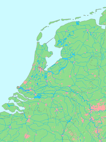
- map shows waterbodies , rivers and canals in Netherlands
derivative works
Derivative works of this file:
Istor ar restr
Klikañ war un deiziad/eur da welet ar restr evel ma oa da neuze.
| Deiziad/Eur | Munud | Mentoù | Implijer | Notenn | |
|---|---|---|---|---|---|
| red | 14 Her 2015 da 13:00 | | 580 × 772 (91 Kio) | Io Herodotus | Afsluitdijk |
| 16 Her 2005 da 15:12 |  | 580 × 772 (77 Kio) | Michiel1972 | cor. | |
| 16 Her 2005 da 13:35 |  | 580 × 772 (77 Kio) | Michiel1972 | *map shows waterbodies , rivers and canals in Netherlands *based on free-licence data/map software http://www.demis.nl/home category:Maps of the Netherlands |
Implij ar restr
Implijout a ra ar bajenn da heul ar restr-mañ :
Implij hollek ar restr
Ober a ra ar wikioù da-heul gant ar restr-mañ :
- Implij war en.wikipedia.org
- Implij war fr.wikipedia.org
- Implij war nl.wikipedia.org
- Implij war ro.wikipedia.org