Restr:Nantes - Erdre.jpg
Restr orin (2 000 × 1 500 piksel, ment ar restr : 866 Kio, seurt MIME : image/jpeg)
![]()
| Tennet eo ar restr-mañ eus Wikimedia Commons ha gallout a ra bezañ implijet evit raktresoù all. Diskouezet eo deskrivadur he fajenn zeskrivañ amañ dindan. |
|
Diverradur
| Deskrivadur |
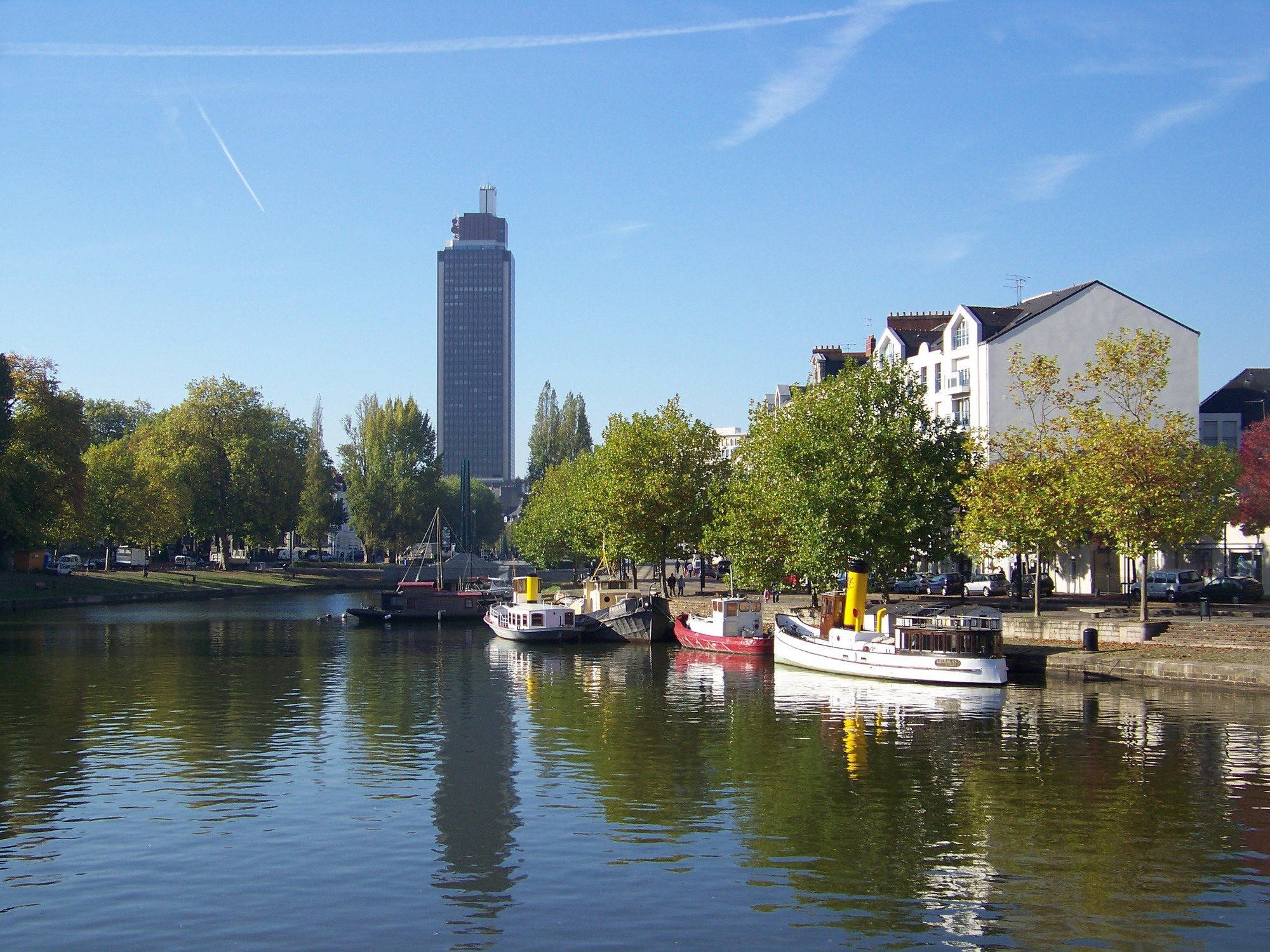
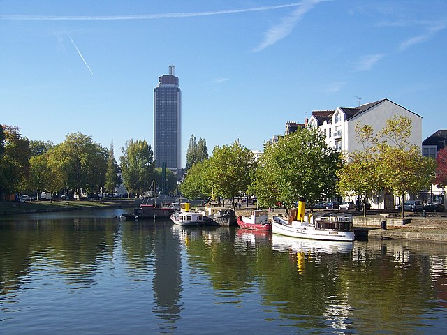
Brezhoneg: Naoned: an Erzh ha Tour Breizh English: Nantes: the Erdre river and the Bretagne tower.
Français : Nantes : l'Erdre et la tour Bretagne. |
|
| Deiziad | ||
| Mammenn | Labour an-unan | |
| Aozer |
| |
| Deroadenn (required by the license) | © Guillaume Piolle / | |
| Lec’h luc’hskeudennerez | | Gwelet al lec’h-se e : OpenStreetMap |
|---|
| Annotations | This image is annotated: View the annotations at Commons |
Aotre-implijout

|
Aotre zo da eilañ, skignañ ha kemmañ an teul-mañ dindan termennoù ar GNU Free Documentation License, stumm 1.2 pe stummoù nevesoc'h embannet gant ar Free Software Foundation; hep rannoù digemm, na testenn pajenn golo 1 pe golo 4 ebet. Kavet e vo un eilskrid eus an aotre-implijout er rannbennad anvet GNU Free Documentation License. |
- Gallout a rit :
- eskemm – eilañ, skignañ ha treuzkas an oberenn-mañ
- kemmañ – azasaat an oberenn-mañ
- diouzh ma heuilhit kement-mañ :
- deroadenn – Rankout a rit reiñ an titouroù perc'henniezh rekis diwar-benn an aozer, pourchas ul liamm war-zu an aotre-implijout ha merkañ hag-eñ ez eus bet graet kemmoù. Gallout a rit en ober en un doare reizh met hep lakaat da grediñ ez oc'h bet aprouet gantañ pe ez eo aprouet gantañ implij an oberenn-mañ.

|
Copyright warning: A subject in this image is protected by copyright.
This image features an architectural or artistic work, photographed from a public space in France. There are limited Freedom of Panorama exemptions in France, which means that they cannot be photographed freely for anything other than non-commercial purposes. However, French jurisprudence states that no infringement is constituted when the work is an "accessory compared to the main represented or handled subject". If a copyrighted architectural or artistic work is contained in this image and it is a substantial reproduction, this photo cannot be licensed under a free license, and will be deleted. Framing this image to focus on the copyrighted work is also a copyright violation. Before reusing this content, ensure that you have the right to do so. You are solely responsible for ensuring that you do not infringe someone else's copyrights. See our general disclaimer for more information. |

Istor ar restr
Klikañ war un deiziad/eur da welet ar restr evel ma oa da neuze.
| Deiziad/Eur | Munud | Mentoù | Implijer | Notenn | |
|---|---|---|---|---|---|
| red | 9 Du 2008 da 16:14 | | 2 000 × 1 500 (866 Kio) | Eusebius | {{Information |Description={{en|1=Nantes: the Erdre river and the Bretagne tower.}} {{fr|1=Nantes : l'Erdre et la tour Bretagne.}} |Source=travail personnel (own work) |Author=Eusebius |Date=2008-10-17 |Perm |
Implij ar restr
Implijout a ra ar bajenn da heul ar restr-mañ :
Implij hollek ar restr
Ober a ra ar wikioù da-heul gant ar restr-mañ :
- Implij war azb.wikipedia.org
- Implij war be-tarask.wikipedia.org
- Implij war bs.wikipedia.org
- Implij war ceb.wikipedia.org
- Implij war de.wikipedia.org
- Implij war el.wikipedia.org
- Implij war en.wikipedia.org
- Implij war eu.wikipedia.org
- Implij war fa.wikipedia.org
- Implij war fr.wikipedia.org
- Implij war fr.wikivoyage.org
- Implij war ka.wikipedia.org
- Implij war kk.wikipedia.org
- Implij war ku.wikipedia.org
- Implij war la.wikipedia.org
- Implij war mk.wikipedia.org
- Implij war mr.wikipedia.org
- Implij war mt.wikipedia.org
- Implij war mzn.wikipedia.org
- Implij war pnb.wikipedia.org
- Implij war ru.wikipedia.org
- Implij war sco.wikipedia.org
- Implij war tl.wikipedia.org
- Implij war tr.wikipedia.org
- Implij war xmf.wikipedia.org
- Implij war zh.wikipedia.org