Restr:South Orkney Islands-en.svg

Ment rakwel PNG ar restr SVG : 800 × 476 piksel. pizhderioù all : 320 × 190 piksel | 640 × 381 piksel | 1 024 × 609 piksel | 1 280 × 761 piksel | 2 560 × 1 523 piksel | 2 303 × 1 370 piksel.
Restr orin (restr SVG file, pizhder 2 303 × 1 370 piksel, ment ar restr : 252 Kio)
![]()
| Tennet eo ar restr-mañ eus Wikimedia Commons ha gallout a ra bezañ implijet evit raktresoù all. Diskouezet eo deskrivadur he fajenn zeskrivañ amañ dindan. |
Diverradur
| Deskrivadur |
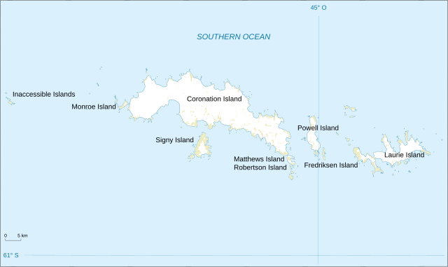
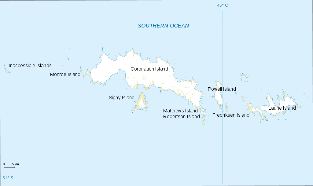
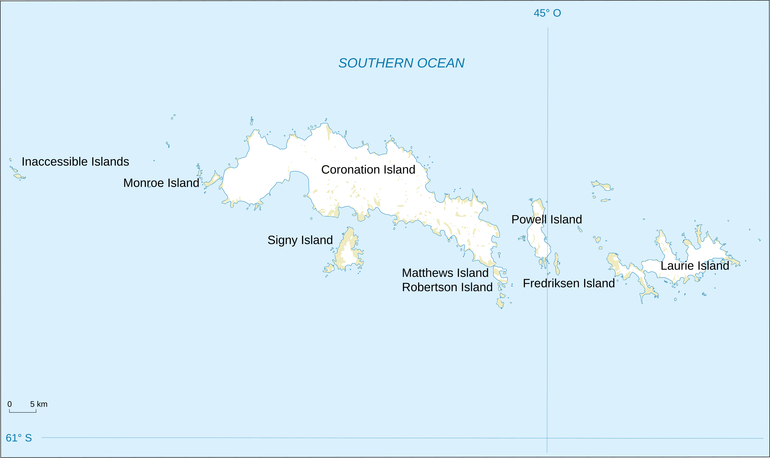
English: Map of South Orkney Islands.
Français : Carte des Iles Orcades du Sud.
Italiano: Mappa delle Isole Orcadi Meridionali. |
| Deiziad | |
| Mammenn | Landsat Image Mosaic Of Antarctica (LIMA) |
| Aozer | Shakki |
| Stummoù all |
|


Aotre-implijout
This image is in the public domain in the United States because it only contains materials that originally came from the United States Geological Survey, an agency of the United States Department of the Interior. For more information, see the official USGS copyright policy.
|
Istor ar restr
Klikañ war un deiziad/eur da welet ar restr evel ma oa da neuze.
| Deiziad/Eur | Munud | Mentoù | Implijer | Notenn | |
|---|---|---|---|---|---|
| red | 17 Meu 2008 da 18:32 | | 2 303 × 1 370 (252 Kio) | Shakki | {{Information |Description={{en|Map of South Orkney Islands}} {{fr|Carte des Iles Orcades du Sud}} |Source=[http://gisdata.usgs.gov/website/antarctic_research_atlas/ Landsat Image Mosaic Of Antarctica (LIMA)] |Date=Mar 2008 |Author=Shakki |
Implij ar restr
Implijout a ra ar bajenn da heul ar restr-mañ :
Implij hollek ar restr
Ober a ra ar wikioù da-heul gant ar restr-mañ :
- Implij war af.wikipedia.org
- Implij war ang.wikipedia.org
- Implij war ar.wikipedia.org
- Implij war ast.wikipedia.org
- Implij war az.wikipedia.org
- Implij war be.wikipedia.org
- Implij war bs.wikipedia.org
- Implij war ca.wikipedia.org
- Implij war ceb.wikipedia.org
- Implij war cs.wikipedia.org
- Implij war da.wikipedia.org
- Implij war de.wikipedia.org
- Implij war el.wikipedia.org
- Implij war en.wikipedia.org
- South Orkney Islands
- Scottish National Antarctic Expedition
- Laws Glacier
- Buchanan Point
- Orwell Glacier
- Jane Peak
- Sunshine Glacier
- Cape Murdoch
- Cape Mabel
- McLeod Glacier (South Orkney Islands)
- Thomson Point
- Cape Valavielle
- Cape Robertson
- Roald Glacier
- Tioga Lake (South Orkney Islands)
- Three Lakes Valley (South Orkney Islands)
- Module:Location map/data/South Orkney Islands
- Module:Location map/data/South Orkney Islands/doc
- Implij war es.wikipedia.org
- Implij war fa.wikipedia.org
Gwelet muioc'h eus implij hollek ar restr-mañ.