Restr:Spanish-virgin-islands.jpg
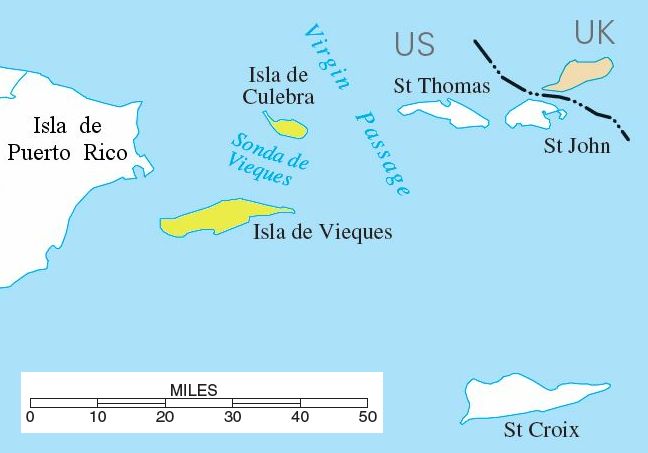
Spanish-virgin-islands.jpg (648 × 453 piksel, ment ar restr : 30 Kio, seurt MIME : image/jpeg)
Istor ar restr
Klikañ war un deiziad/eur da welet ar restr evel ma oa da neuze.
| Deiziad/Eur | Munud | Mentoù | Implijer | Notenn | |
|---|---|---|---|---|---|
| red | 10 Eos 2006 da 13:39 |  | 648 × 453 (30 Kio) | Eoghanacht | {{Information |Description= {{w|Spanish Virgin Islands}} with surrounding islands. {{coor dm|18|18|51|N|65|18|W|}}. |Source= National Atlas of the United States[http://nationalatlas.gov/printable/images/pdf/rivers/pagehyd_pr4.pdf] |Date= |Author= |Permiss |
Implij ar restr
Implijout a ra ar bajenn da heul ar restr-mañ :
Implij hollek ar restr
Ober a ra ar wikioù da-heul gant ar restr-mañ :
- Implij war ar.wikipedia.org
- Implij war da.wikipedia.org
- Implij war en.wikipedia.org
- Implij war eo.wikipedia.org
- Implij war es.wikipedia.org
- Implij war fa.wikipedia.org
- Implij war fr.wikipedia.org
- Implij war hr.wikipedia.org
- Implij war it.wikipedia.org
- Implij war ja.wikipedia.org
- Implij war ko.wikipedia.org
- Implij war lb.wikipedia.org
- Implij war nl.wikipedia.org
- Implij war no.wikipedia.org
- Implij war pnb.wikipedia.org
- Implij war pt.wikipedia.org
- Implij war ro.wikipedia.org
- Implij war ru.wikipedia.org
- Implij war ta.wikipedia.org
- Implij war uk.wikipedia.org
- Implij war ur.wikipedia.org
- Implij war www.wikidata.org
- Implij war zh.wikipedia.org


