Restr:Western Europe Utrecht Treaty.jpg

Restr orin (1 576 × 1 257 piksel, ment ar restr : 388 Kio, seurt MIME : image/jpeg)
![]()
| Tennet eo ar restr-mañ eus Wikimedia Commons ha gallout a ra bezañ implijet evit raktresoù all. Diskouezet eo deskrivadur he fajenn zeskrivañ amañ dindan. |
Diverradur
| Deskrivadur |
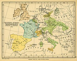
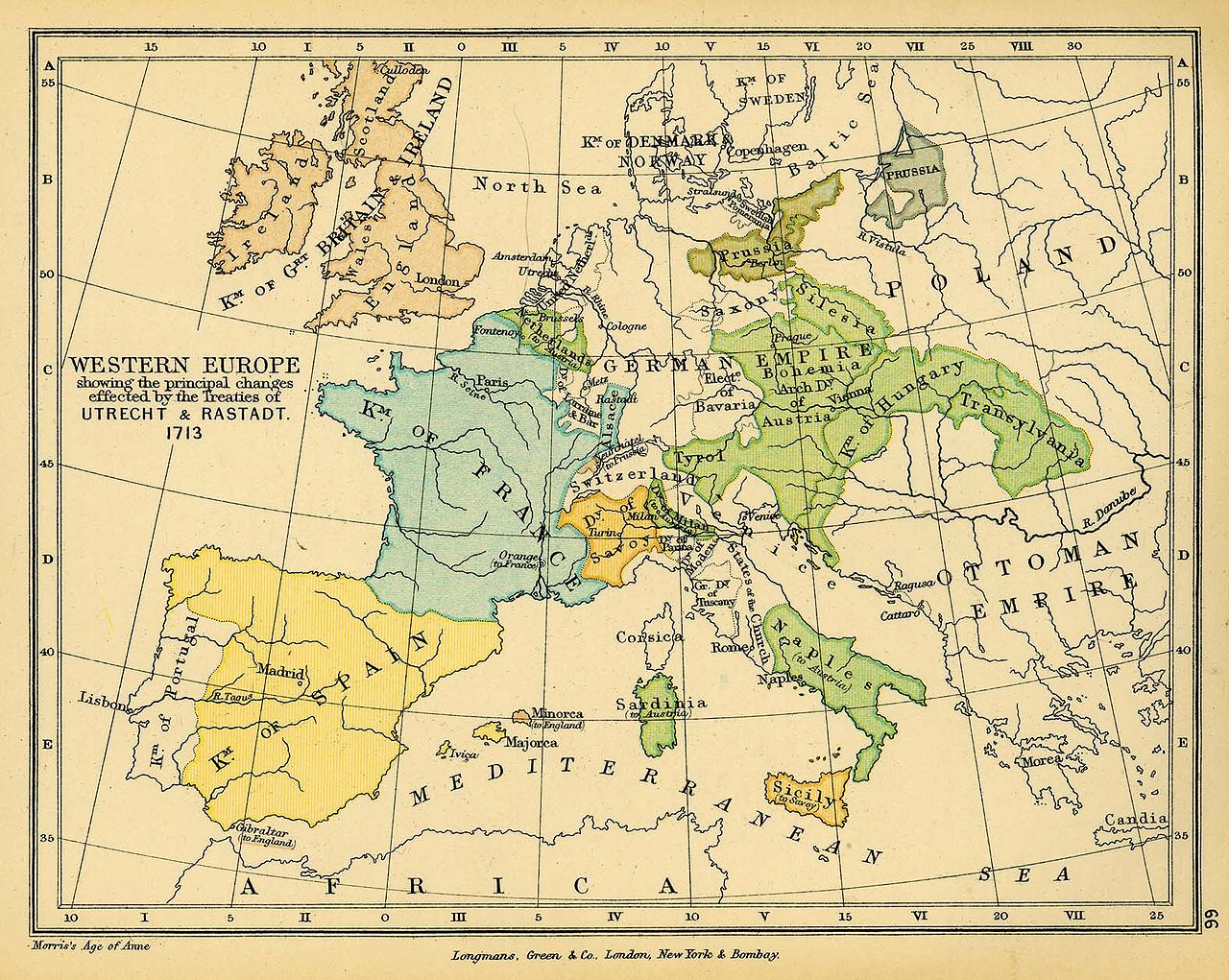
English: Map of Western Europe in 1713. |
| Deiziad | |
| Mammenn |
|
| Aozer | Charles Colbeck |
El mapa de la Pau d'Utrecht (tractat d'Utrecht) és incorrecte, ja que córsega pertany a l'imperi Austríac un cop es acceptat aquest tractat.
Hibás térkép! Magyarország 1699-ben (a karlócai békével) majdnem teljes mértékben felszabadult (teljesen csak 1718-ban, a pozsareváci békével). A térkép Kelet-Európai része az 1670-1680-as évekbeli képét mutatja.
Aotre-implijout
|
The author died in 1902, so this work is in the public domain in its country of origin and other countries and areas where the copyright term is the author's life plus 100 years or fewer. This work is in the public domain in the United States because it was published (or registered with the U.S. Copyright Office) before January 1, 1929. | |
| Rummet eo bet ar restr-mañ e-touez ar restroù hep strishadurioù implij anavezet evit ar pezh a sell ouzh ar gwirioù aozer, ha kement-se evit an holl wirioù kar ha stag. | |
Istor ar restr
Klikañ war un deiziad/eur da welet ar restr evel ma oa da neuze.
| Deiziad/Eur | Munud | Mentoù | Implijer | Notenn | |
|---|---|---|---|---|---|
| red | 24 Du 2006 da 16:38 | | 1 576 × 1 257 (388 Kio) | Louis le Grand~commonswiki | {{Information |Beschreibung= Landkarte Europa 1713 nach dem Frieden von Utrecht |Quelle= http://www.lib.utexas.edu/maps/historical/colbeck/western_europe_utrecht_treaty.jpg |Urheber= "The Public Schools Historical Atlas" by Charles Colbeck. Longmans, Gree |
Implij ar restr
Implijout a ra an 2 pajenn da heul ar restr-mañ :
Implij hollek ar restr
Ober a ra ar wikioù da-heul gant ar restr-mañ :
- Implij war als.wikipedia.org
- Implij war ar.wikipedia.org
- Implij war ast.wikipedia.org
- Implij war bg.wikipedia.org
- Implij war ca.wikipedia.org
- Implij war cs.wikipedia.org
- Implij war da.wikipedia.org
- Implij war de.wikipedia.org
- Implij war en.wikipedia.org
- Implij war eo.wikipedia.org
- Implij war eu.wikipedia.org
- Implij war fi.wikipedia.org
- Implij war fr.wikipedia.org
- Implij war fr.wikiversity.org
- Implij war he.wikipedia.org
- Implij war hu.wikipedia.org
- Implij war hy.wikipedia.org
- Implij war is.wikipedia.org
- Implij war it.wikipedia.org
- Implij war it.wikibooks.org
- Implij war ja.wikipedia.org
- Implij war ka.wikipedia.org
- Implij war ko.wikipedia.org
Gwelet muioc'h eus implij hollek ar restr-mañ.