Restr:Wfm firth of forth.jpg

Ment ar rakweled-mañ : 800 × 593 piksel. pizhderioù all : 320 × 237 piksel | 640 × 474 piksel | 1 024 × 758 piksel | 1 280 × 948 piksel.
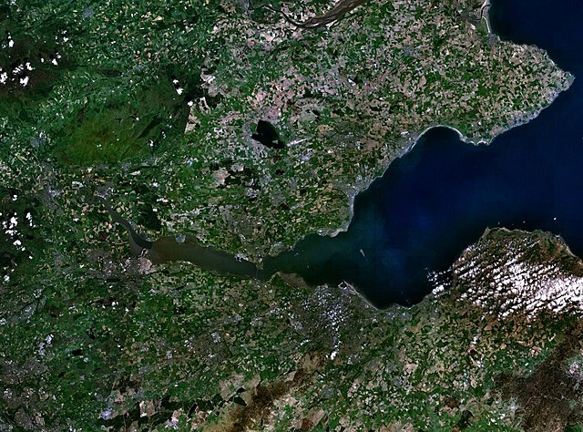
Restr orin (1 280 × 948 piksel, ment ar restr : 289 Kio, seurt MIME : image/jpeg)
![]()
| Tennet eo ar restr-mañ eus Wikimedia Commons ha gallout a ra bezañ implijet evit raktresoù all. Diskouezet eo deskrivadur he fajenn zeskrivañ amañ dindan. |
Diverradur
| Deskrivadur |
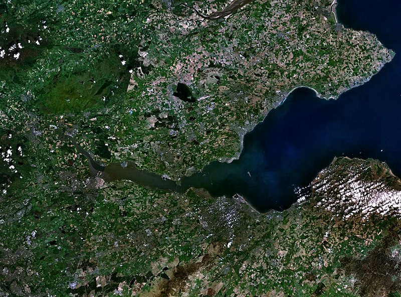
English: The Firth of the river Forth, on the east coast of Scotland. The two forth bridges are visible near the centre of the frame. Stirling is at the extreme left side. |
| Deiziad | 3 Eost 2005 (upload date) |
| Mammenn | Satellite imagery taken by screenshot from NASA World Wind software |
| Aozer | NASA |
Aotre-implijout
| This image is in the public domain because it is a screenshot from NASA’s globe software World Wind using a public domain layer, such as Blue Marble, MODIS, Landsat, SRTM, USGS or GLOBE.
|
 |
Istor ar restr
Klikañ war un deiziad/eur da welet ar restr evel ma oa da neuze.
| Deiziad/Eur | Munud | Mentoù | Implijer | Notenn | |
|---|---|---|---|---|---|
| red | 3 Eos 2005 da 09:38 | | 1 280 × 948 (289 Kio) | Finlay McWalter | The Firth of the river Forth, on the east coast of Scotland. The two forth bridges are visible near the centre of the frame. Stirling is at the extreme left side. Image made with NASA World Wind. {{PD-USGov-NASA}} category:satellite photos |
Implij ar restr
Implijout a ra an 2 pajenn da heul ar restr-mañ :
Implij hollek ar restr
Ober a ra ar wikioù da-heul gant ar restr-mañ :
- Implij war ar.wikipedia.org
- Implij war be.wikipedia.org
- Implij war bg.wikipedia.org
- Implij war ca.wikipedia.org
- Implij war ceb.wikipedia.org
- Implij war cs.wikipedia.org
- Implij war cy.wikipedia.org
- Implij war de.wikipedia.org
- Implij war el.wikipedia.org
- Implij war en.wikipedia.org
- Implij war en.wikivoyage.org
- Implij war eo.wikipedia.org
- Implij war es.wikipedia.org
- Implij war et.wikipedia.org
- Implij war eu.wikipedia.org
- Implij war fa.wikipedia.org
- Implij war fr.wikipedia.org
- Implij war ga.wikipedia.org
- Implij war gd.wikipedia.org
- Implij war ha.wikipedia.org
- Implij war he.wikipedia.org
- Implij war hi.wikipedia.org
- Implij war ia.wikipedia.org
- Implij war is.wikipedia.org
- Implij war it.wikipedia.org
- Implij war it.wikivoyage.org
- Implij war ja.wikipedia.org
- Implij war kbd.wikipedia.org
- Implij war lt.wikipedia.org
- Implij war mt.wikipedia.org
- Implij war nl.wikipedia.org
- Implij war nn.wikipedia.org
- Implij war no.wikipedia.org
- Implij war pl.wikipedia.org
- Implij war pt.wikipedia.org
- Implij war ro.wikipedia.org
- Implij war ru.wikipedia.org
- Implij war sco.wikipedia.org
Gwelet muioc'h eus implij hollek ar restr-mañ.