Restr:London Thames Sunset panorama - Feb 2008.jpg

Ment ar rakweled-mañ : 800 × 297 piksel. pizhderioù all : 320 × 119 piksel | 640 × 238 piksel | 1 024 × 380 piksel | 1 280 × 475 piksel | 2 560 × 951 piksel | 13 126 × 4 876 piksel.
Restr orin (13 126 × 4 876 piksel, ment ar restr : 17,7 Mio, seurt MIME : image/jpeg)
![]()
| Tennet eo ar restr-mañ eus Wikimedia Commons ha gallout a ra bezañ implijet evit raktresoù all. Diskouezet eo deskrivadur he fajenn zeskrivañ amañ dindan. |
Diverradur
| Deskrivadur |
العربية: صُورة پانوراميَّة من عدَّة مقاطع لأُفق لندن من على ضفَّة برموندساي لنهر التيمز.
Čeština: Podvečerní panorama Londýna
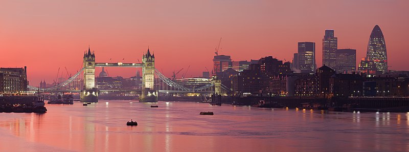
English: A multi segment panoramic image of the London skyline from the Bermondsey banks of the Thames, in which the Tower Bridge and 30 St Mary Axe are visible.
|
| Deiziad | C'hwevrer 2008 (18 C'hwevrer 2008, according to Exif data) |
| Mammenn | Labour an-unan |
| Aozer | Diliff |
| Aotre (Adimplij ar restr-mañ) |
Summary:In using this image or any subsequent derivatives of it, you are required to release the image under the same license. As such, any reproduction of this image, in any medium, must appear with a copy of, or full URL of the license.Attribution of this image to the author (DAVID ILIFF) is also required, preferably in a prominent location near the image.No other conditions may be added to, or removed from this license without the permission of the author and copyright holder.Suggested attribution: "Photo by DAVID ILIFF. License: CC BY-SA 3.0"Please review the full license requirements carefully before using this image. If you would like to clarify the terms of the license or negotiate less restrictive commercial licensing outside of the bounds of GFDL/CC-BY-SA, please contact me by email, or if you don't have a Wikipedia account you can either leave a message on my talk page with your contact details and your request, or you can contact me on Facebook. Please also send a 'friend request' to ensure that I am aware of your message. |
| Stummoù all |
Derivative works of this file: |
| Lec’h luc’hskeudennerez | | Gwelet al lec’h-se e : OpenStreetMap |
|---|
|

.jpg)
This image was selected as picture of the day on Wikimedia Commons for 27 July 2012. It was captioned as follows: Other languages:
Русский: Панорама Лондона, столицы Олимпийских игр 2012 года മലയാളം : ലണ്ടൻ, 2012 ഒളിമ്പിക്സിന്റെ ആതിഥേയ പട്ടണം. |
Aotre-implijout
Evel perc'henn eus ar gwirioù oberour, e embannan an oberenn-mañ dindan an aotreoù-implijout da-heul :

|
Aotre zo da eilañ, skignañ ha kemmañ an teul-mañ dindan termennoù ar GNU Free Documentation License, stumm 1.2 pe stummoù nevesoc'h embannet gant ar Free Software Foundation; hep rannoù digemm, na testenn pajenn golo 1 pe golo 4 ebet. Kavet e vo un eilskrid eus an aotre-implijout er rannbennad anvet GNU Free Documentation License. |
Emañ ar restr-mañ dindan an aotre-implijout Creative Commons Deroadenn 3.0 Diborzh
- Gallout a rit :
- eskemm – eilañ, skignañ ha treuzkas an oberenn-mañ
- kemmañ – azasaat an oberenn-mañ
- diouzh ma heuilhit kement-mañ :
- deroadenn – Rankout a rit reiñ an titouroù perc'henniezh rekis diwar-benn an aozer, pourchas ul liamm war-zu an aotre-implijout ha merkañ hag-eñ ez eus bet graet kemmoù. Gallout a rit en ober en un doare reizh met hep lakaat da grediñ ez oc'h bet aprouet gantañ pe ez eo aprouet gantañ implij an oberenn-mañ.
Gallout a rit diuzañ an aotre-implijout a fell deoc'h.
Istor ar restr
Klikañ war un deiziad/eur da welet ar restr evel ma oa da neuze.
| Deiziad/Eur | Munud | Mentoù | Implijer | Notenn | |
|---|---|---|---|---|---|
| red | 18 Mae 2015 da 17:39 | 13 126 × 4 876 (17,7 Mio) | Diliff | fixed stitching error | |
| 10 Mae 2015 da 17:26 | 13 126 × 4 876 (17,63 Mio) | Diliff | higher resolution version | ||
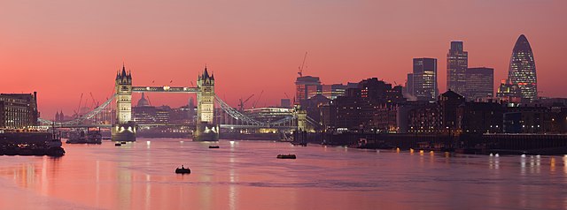
| 1 Meu 2008 da 13:23 | 2 500 × 932 (685 Kio) | Diliff | {{Information |Description=A multi segment panoramic image of the London skyline from the Bermondsey banks of the Thames. Taken by myself with a Canon 5D and 70-200mm f/2.8L lens. |Source=self-made |Date=Feb 2008 |Author= Diliff |Permissio |
Implij ar restr
Implijout a ra ar bajenn da heul ar restr-mañ :
Implij hollek ar restr
Ober a ra ar wikioù da-heul gant ar restr-mañ :
- Implij war ace.wikipedia.org
- Implij war af.wikipedia.org
- Implij war am.wikipedia.org
- Implij war ar.wikipedia.org
- نهر التمز
- مستخدم:ديفيد/صور ساهمت في جعلها مختارة
- بوابة:إنجلترا/صورة مختارة
- بوابة:إنجلترا/صورة مختارة/أرشيف
- ويكيبيديا:ترشيحات الصور المختارة/جسر البرج بلندن
- بوابة:إنجلترا/صورة مختارة/9
- ويكيبيديا:صور مختارة/أماكن/رؤية شاملة
- بوابة:أوروبا/صورة مختارة/أرشيف
- بوابة:أوروبا/صورة مختارة/8
- ويكيبيديا:صورة اليوم المختارة/يوليو 2015
- قالب:صورة اليوم المختارة/2015-07-14
- ويكيبيديا:صورة اليوم المختارة/سبتمبر 2016
- قالب:صورة اليوم المختارة/2016-09-21
- ويكيبيديا:صورة اليوم المختارة/يوليو 2018
- قالب:صورة اليوم المختارة/2018-07-10
- ويكيبيديا:صورة اليوم المختارة/يوليو 2021
- قالب:صورة اليوم المختارة/2021-07-05
- Implij war ast.wikipedia.org
- Implij war azb.wikipedia.org
- Implij war ban.wikipedia.org
- Implij war bcl.wikipedia.org
- Implij war be-tarask.wikipedia.org
- Implij war be.wikipedia.org
- Implij war bh.wikipedia.org
- Implij war bn.wikipedia.org
- Implij war bn.wikivoyage.org
- Implij war bo.wikipedia.org
- Implij war bs.wikipedia.org
- Implij war crh.wikipedia.org
- Implij war cv.wikipedia.org
- Implij war cy.wikipedia.org
- Implij war da.wikipedia.org
- Implij war de.wikipedia.org
Gwelet muioc'h eus implij hollek ar restr-mañ.